
Walk Port Arthur Streets
A Port Arthur address trail starts with place, not a name. The postal spelling, city boundary, appraisal situs, owner mailing line, deed description, directory listing, and voter address can all differ. That is normal. Use the USPS ZIP Lookup to standardize the address, then place it on the city and county map layers. The JCAD account supplies the parcel identifiers that connect the address to recorded instruments. A person named in a directory or voter result needs matching address and date context before it becomes useful household evidence.
- Enter the complete address in USPS and save the standardized street, city, ZIP, and ZIP+4 when shown.
- Check the address in Port Arthur GIS and Jefferson County Engineering layers for city limits, ETJ, precinct, zoning, drainage, flood, right-of-way, and subdivision context.
- Search JCAD by Street Number and simplified Street Name. Do not add a prefix, suffix, or unit number in that street-name field.
- Copy the Property ID, Geographic ID, situs, legal description, owner name, mailing address, improvement details, and deed-history rows.
- Use the legal description in the County Clerk search, then record each grantor, grantee, date, document number, and deed type.
- Request permit and inspection material by exact address and date span when the building history matters.
- For earlier households, check the street or reverse section and both adjacent house numbers in the available directory editions.
Each step narrows a different question. A Port Arthur parcel account identifies an appraisal record. The deed chain traces transfers. A directory gives a dated listing, often for a subscriber or household head. The state voter route is a current registration and polling check, not a certificate that a person currently occupies the property.
JCAD Fields for Port Arthur Streets
Jefferson County Appraisal District, commonly called JCAD, maintains more than 150,000 parcels and uses County Clerk deed records to correct ownership. Its information is described as research-only, and it does not levy or collect taxes. For an address search, the practical fields are narrow and deliberate. Use the street number with a simplified street name, then inspect the returned situs and legal description before treating a result as the same place.
| JCAD control | How it accepts a search | Street research use |
|---|---|---|
| Owner Name | Last Name First Name; a first or last name may work | Tests an owner name after the parcel is identified |
| Street Number | Address component | Pairs with Street Name for a direct address search |
| Street Name | No prefix, suffix, or unit number | Finds the street without a full postal-format string |
| Property ID | Parcel identifier | Returns to one appraisal account after an address search |
| Geographic ID | Geographic account identifier | Helps preserve the parcel reference in research notes |
| Subdivision | Autocomplete list and search | Connects a tract or block to the deed search |
The live form also includes advanced fields such as abstract, neighborhood, property type, tax year, and owner ID. For Port Arthur property records, the fetched form did not expose a verified option list for every selector, and JCAD did not publish an online historical backfile start year. Record the tax year shown on a result and verify legal descriptions and acreage before relying on them for a legal matter.
Map Each Port Arthur Address
The Port Arthur GIS mapping page and Jefferson County Engineering maps answer a different question from JCAD. The Port Arthur GIS layers show location and jurisdiction, including city limits and ETJ, zoning, drainage, voting and precinct areas, coastal context, parks, transit, and street-related layers. County Engineering adds aerial imagery, FEMA flood zones, right-of-way, subdivisions, and school, JP, election, polling, and historical-marker layers. The parcel record supplies an account; a map supplies geography.
That distinction matters in southeastern Jefferson County. Port Arthur is primarily in Jefferson County, while a small eastern, industrial, and limited-annexation area can involve Orange County. A Port Arthur postal city label is not enough to select a custodian. Test the actual situs against the current boundary layer, then preserve the map date in the notes. County Engineering can be reached at 409-835-8584 when a map layer or right-of-way question needs confirmation.
Note: Map layers have separate dates and purposes, so a precinct or drainage overlay should not be treated as a present household list.
Port Arthur Address Record Coverage
Records searchable by street do not carry equal weight. Use the layer that matches the question, and retain its limit beside the result. JCAD identifies a current appraisal account. The Clerk indexes recorded instruments. Permit files capture regulated work. Historical directories create dated household or subscriber leads. Together, they form an address chain without turning one row into a claim about every person connected to a property.
| Address record | Port Arthur signal | Era or limit | Access path |
|---|---|---|---|
| JCAD appraisal account | Situs, owner of record, mailing address, values, improvements | Current tax-year data; portal backfile start not published | JCAD search or district office |
| Recorded deed index | Grantor, grantee, legal description, date, and document number | Online historical start not published; older deed series use microfilm | County Official Records, Clerk, or TSLAC |
| City permit file | Applicant or contractor, work type, address, permit and inspection dates | No public searchable historical database located | Inspections counter or written request |
| City GIS layer | Boundary, street, parcel, zoning, drainage, and precinct context | Layer dates differ | City GIS and County Engineering |
| Directory run | Dated resident, subscriber, business, or address listing | Hughes holdings from 1925 to 2006 with gaps | Hughes, PAPL, UT, and library databases |
The Port Arthur City Secretary and city departments can also route a written request under the Texas Public Information Act. State the exact address, legal description when known, record series, and date range. The public request process is a fallback for city-held permit ledgers, inspections, minutes, code records, and correspondence that a web form does not expose.
Port Arthur Street Directory Deeds
An address search can begin with a JCAD account, but title research continues in the Jefferson County Clerk index. Its quick search accepts a grantor or grantee, subdivision, document type, or document number, with recorded-date fields and Index Only or Index and Full Text OCR choices. Search the legal description as well as names. Index Only separates terms, while OCR can support a phrase when two or more words are entered. Save the document number, book or page when available, and instrument date before moving backward.
The Jefferson County Official Records search is the current recorded-property route. The portal displayed a certification-date notice, but it did not publish a start year for online records. For older records, TSLAC lists Jefferson County Deed Record 1834-1887 and direct/reverse deed-index reels, as well as selected deeds through 1939. A no-result online therefore calls for the Clerk counter, a copy request, or the microfilm route, not a conclusion that no deed exists.
See the official recorded-property search before entering a street-history request. Its search screen makes the distinction between a broad name search and a document-focused follow-up visible.
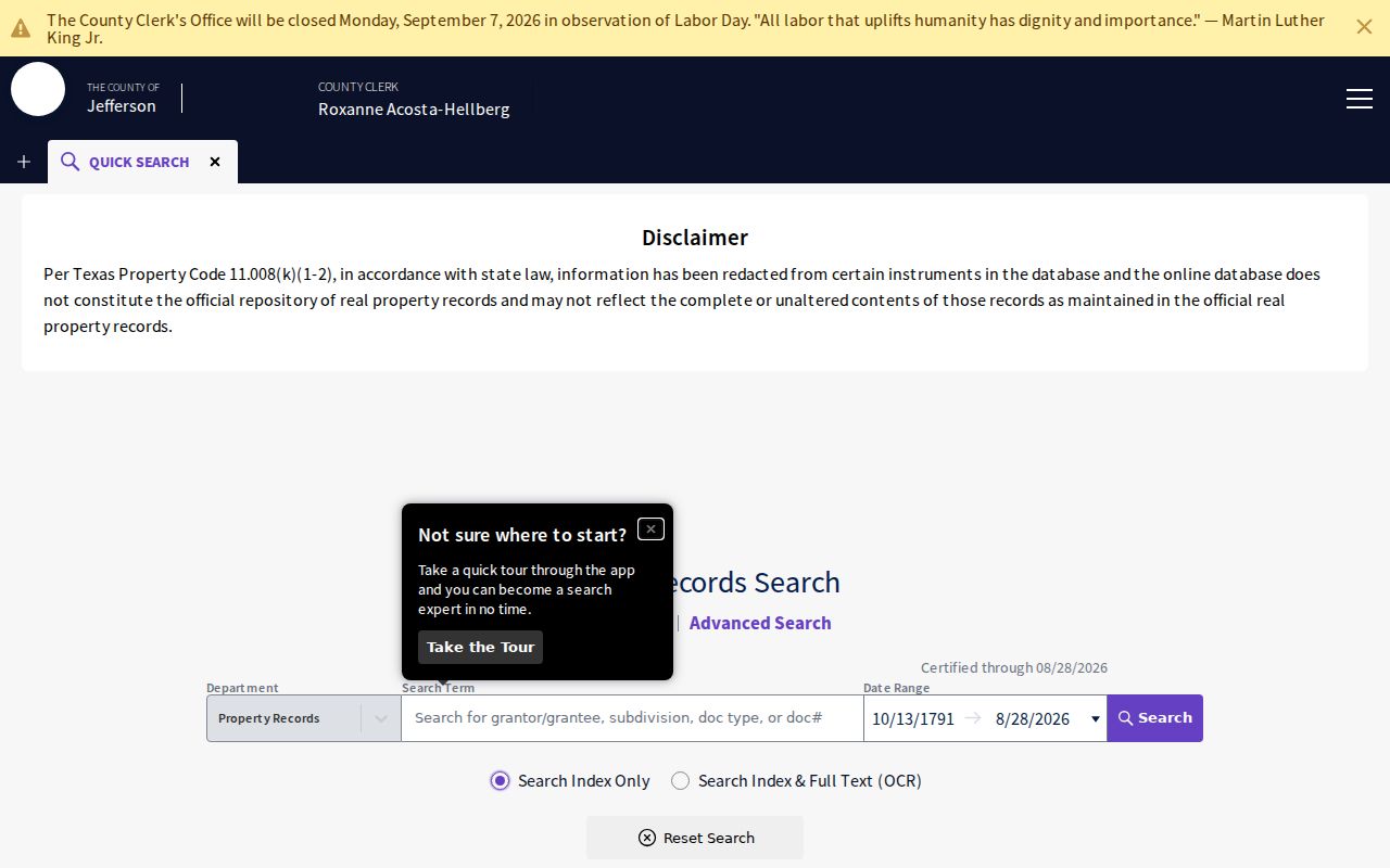
The index supplies a lead to the recorded instrument. Read the image or obtain the Clerk copy before treating a deed-history row as the complete record.
- Parcel
- An appraisal account for a piece of property. Its Property ID and Geographic ID help keep an address search tied to the right record.
- Situs address
- The property location used in an appraisal record. It can differ from an owner mailing address.
- Plat
- A recorded map that lays out lots, blocks, streets, or subdivisions. It can explain an older legal description.
- Criss-cross directory
- A reverse address section that can list a household or subscriber under a street number rather than a surname.
Port Arthur Street Directory Permits
Permit and inspection files add dates and building context to a street search. Port Arthur Inspections and Permitting publishes building, mechanical, structural-moving, plumbing and gas, electrical, stormwater, and temporary street-closure forms. The Port Arthur department’s building requirements describe site plans or surveys, setbacks, professional plans where applicable, foundation and trade inspections, flood-zone steps, and wind-load design. These records may name an applicant or contractor and describe work, but they do not establish that person as an occupant.
Ask for the file by full street address, legal description, permit number if known, date range, and record type. For a long address history, include demolition, remodel, new construction, elevation certificate, certificate of occupancy, and stormwater material. The department publishes 409-983-8261 for contact. If a specific file is not online, the city’s request route and permitting counter are the practical alternatives.
The Port Arthur inspections and permitting page shows the address-linked forms and department entry point used for this part of the trail.
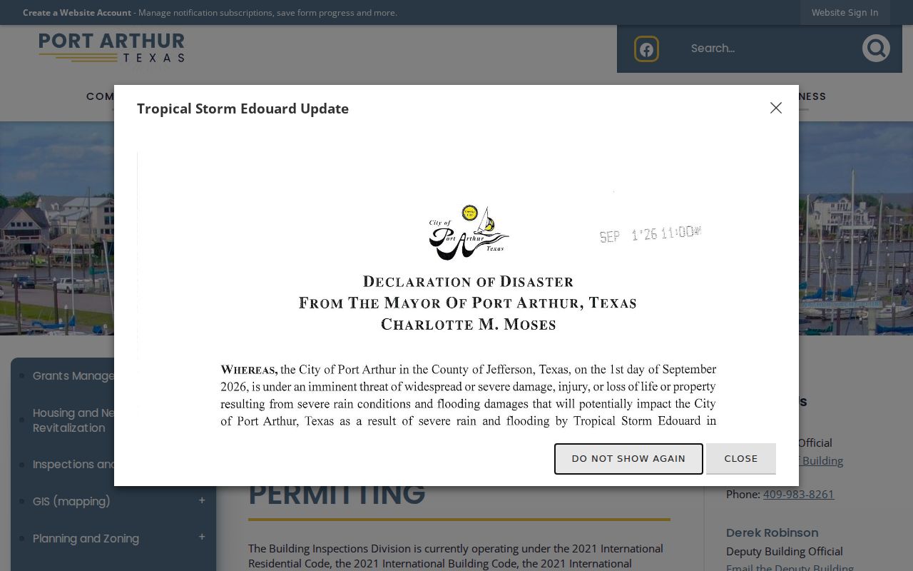
A permit date can help place physical work in time. Pair it with the parcel, instrument, and directory evidence rather than using it as household proof.
Port Arthur Address Labels
Old Port Arthur street research needs a boundary timeline. Platting began in December 1895, and the city’s boundary material records a 1913 limited extension along the Sabine-Neches Canal and Sabine River. Later files show city-limit actions in 1950-54, limited annexation in 1976 and 1978, an ETJ release near Bridge City in 1999, a Taylor’s Landing release in 2005, and industrial or limited-annexation action in 2017. The 1950 material also names the Catholic Cemetery Area and the Lakeview-to-Main Avenue area.
Use those events to interpret an older local label, not to force a match. A record filed under Lakeview, Port Acres, Sabine Pass, Griffing Park, or a nearby city can describe the directory’s local geography instead of a current legal boundary. No official source in the research verifies a citywide street-renumbering year. Test a number change against Port Arthur plats, Sanborn sheets, ordinances, permits, and directory runs for that individual address.
Old Port Arthur Street Listings
The historical street layer is strongest when it is used as a dated listing, not a present-tense roster. The Marion and Ed Hughes Public Library holds Port Arthur directory years from 1925 through 2006, with gaps. UT metadata identifies Worley Port Arthur and Vicinity issues for 1921, 1923, 1931, 1957, and 1958, while Southwestern Bell metadata spans 1924 through 1998 in listed issues. A reverse section, when present, lets the Port Arthur address search work from a number to a listed household or subscriber.
Start at the known number, then inspect both adjacent numbers. Repeat in the preceding and following available editions. Next, search each surname alphabetically for initials, spouse conventions, a phone subscriber, or an alternate address. An absent name can mean a missing edition, a different spelling, a changed neighborhood label, or an unlisted household. The historical collection details belong with the Port Arthur Directory Book; use that shelf as a companion to an address-led trail.
Note: A directory line proves a listing in that edition, not legal ownership or a current household connection.
Port Arthur Streets Before ZIPs
Modern ZIP fields should not be pushed backward into printed records. The Texas General Land Office lists 77640, 77641, 77642, and 77643 for Port Arthur, while a city community report also names 77655. USPS delivery geography does not set city limits. A street delivery ZIP, a P.O. Box format, and a parcel situs all serve different purposes. The sample JCAD address uses 77640, Port Arthur Public Library uses 77642, and city or county mailing formats can use 77641 P.O. Box addresses.
Pre-ZIP directory and deed research works better with the street, vicinity name, subdivision, block and lot, precinct, and post-office label. For a Port Arthur historic address, search the Clerk by legal description, not a modern ZIP. If a current address changes form, preserve the original wording alongside its USPS-standardized counterpart so later checks can be repeated.
Port Arthur Street Directory Limits
An address-record search cannot prove present occupancy from a parcel, mailing line, directory entry, or voter status alone. JCAD’s sample parcel 326302 illustrates the point: the situs is in Port Arthur while the owner mailing address is in Houston. The Port Arthur appraisal record is useful precisely because it keeps property location and mailing information separate. Deed transfers show title chronology, not every person who lived at a location. Telephone directories also omit unlisted numbers and may identify only a subscriber.
Texas voter information has separate confidentiality rules. Protected or substitute addresses may not appear publicly, and a registration result can change without explaining a move. Use only the amount of information needed for personal, lawful research, such as family history, estate questions, civic context, or checking a property record. Keep sensitive address information out of notes that will be shared.
Lawful use. Port Arthur address records support careful personal research. Using any record to stalk, harass, threaten, or harm another person is prohibited.