
Port Arthur ZIP Code Coverage
The Port Arthur ZIP code directory starts with two official-looking sources that should be kept together, not collapsed into one boundary claim. The Texas General Land Office geographic-code list has Port Arthur entries for 77640, 77641, 77642, and 77643. A City of Port Arthur community report includes those four plus 77655. ZIP codes are delivery geographies, not incorporated-city polygons, so the city report’s association with 77655 needs an address-level USPS and jurisdiction check.
| ZIP | Documented Port Arthur use | Post-office or address note | Research caution |
|---|---|---|---|
| 77640 | Port Arthur street-delivery ZIP | The inspected JCAD situs at 925 West Jade Avenue uses Port Arthur 77640. | Validate each address with USPS; a ZIP is not a city-limit finding. |
| 77641 | Port Arthur GLO entry and local mailing use | City and county mailing addresses commonly use the 77641-1089 P.O. Box form. | A post-office-box ZIP is not parcel situs. |
| 77642 | Port Arthur GLO entry and local street or library use | Port Arthur Public Library uses 77642. | Confirm the delivery city and ZIP for the exact location. |
| 77643 | Port Arthur GLO entry | It appears in local post-office-box-style patterns. | A ZIP-only match does not locate a parcel or resident. |
| 77655 | City community report lists it as city-associated | Static research did not establish its exact USPS city or area classification. | Verify whether it is a preferred city, nearby delivery area, or report inclusion. |
This coverage is a research map, not a claim that each ZIP serves only Port Arthur. Postal boundaries may cross city limits, ETJ areas, census places, school districts, or county and municipal lines.
Note: Confirm the delivery result and city jurisdiction separately because the same ZIP code can cross several local boundary systems.
Port Arthur USPS ZIP Code Fields
The verified ZIP-capable screen is the USPS ZIP Code Lookup. Its three modes solve different postal questions. By Address standardizes a specific delivery address. By City and State returns postal possibilities for a locality. Cities by ZIP Code starts from the code itself. USPS advises adding more of the street address or unit when several results are possible, and expressly says that a result does not confirm a person or company at an address.
| USPS mode | Visible field | Required | Use in Port Arthur research |
|---|---|---|---|
| By Address | Company | No | Optional postal detail only. |
| By Address | Street Address | Yes | Start with the full street delivery address. |
| By Address | Apt/Suite/Other | No | Add it to narrow multiple matches. |
| By Address | City, State, ZIP Code | ZIP optional | Compare the standardized result to the local source list. |
| By City and State | City and State | Yes | Check postal possibilities for a named locality. |
| Cities by ZIP Code | ZIP Code | Yes | See city possibilities without treating them as jurisdiction. |
The USPS lookup screen is shown below as the source for the fields and modes described here.
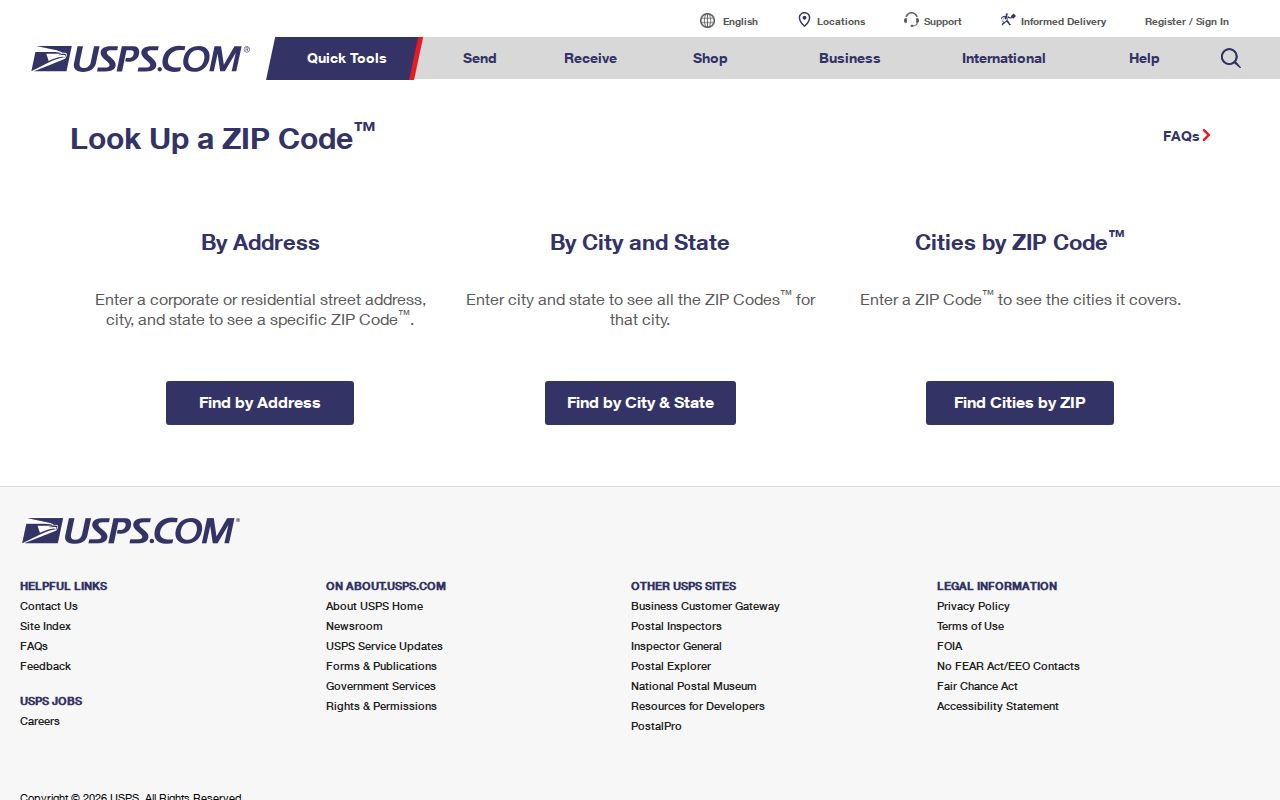
Save the standardized address and ZIP+4 if the live result supplies them. Dynamic result rows and preferred-city behavior should be checked when the address is actually searched.
Port Arthur ZIP Code Search Process
A ZIP-first process uses the postal result to organize an address search, then moves to local geographic and recorded-property sources. No public ZIP-wide resident export is documented. The Jefferson County voter-file route is controlled through the state request form, fees, and sworn-use requirements, not an unrestricted web result. The County Clerk index is also not a ZIP directory because historical instruments may use legal descriptions instead of modern postal codes.
- Enter the full address in USPS By Address and record the standardized city, ZIP, and ZIP+4 when returned.
- Compare the result with the GLO list and the city community report, flagging 77655 or any mismatch for direct confirmation.
- Place the address on Port Arthur GIS or County Engineering layers to check incorporated city, ETJ, county, and related map context.
- Search JCAD by street number and simplified street name to identify the situs, property ID, geographic ID, and legal description.
- Use the County Clerk index by legal description, grantor, grantee, subdivision, or document number when recorded title material is needed.
Once a ZIP has narrowed the location to a particular street, the Port Arthur street directory has the fuller address-by-address sequence.
Note: A ZIP reduction organizes a set of addresses, but legal descriptions and parcel identifiers remain the stronger property search keys.
Port Arthur Parcel Search by ZIP
Jefferson Central Appraisal District is the local parcel layer, but its captured Advanced form does not show a standalone ZIP filter. Its visible fields include owner name, street number, street name, property ID, geographic ID, subdivision, neighborhood, and other appraisal filters. Search the street number and street name without prefix, suffix, or unit number, then inspect the result’s city and ZIP alongside the situs and legal description.
JCAD maintains more than 150,000 parcels, uses County Clerk deed records to correct ownership, and describes online information as research-only. It is the appraisal district, not the title custodian. The sample Port Arthur parcel makes the distinction clear: its situs is in Port Arthur while the owner mailing address is in Houston. Mailing address, owner of record, and occupant are different fields and cannot be exchanged.
Port Arthur ZIP Codes and City Limits
Postal labels and legal geography can disagree in Port Arthur. The city is primarily in Jefferson County, yet a small eastern, industrial, and limited-annexation area is associated with Orange County. The City GIS boundary material, rather than USPS alone, is the right layer for incorporated city limits and ETJ. The county map layers also carry different dates and purposes. A postal city in a returned address does not decide the custodian for a parcel, permit, deed, or municipal record.
- ZIP code
- A postal delivery geography used to sort mail. It is not a municipal-boundary polygon or a person record.
- ZIP+4
- An added delivery detail that can narrow the postal result for a particular address or delivery segment.
- PO-box ZIP
- A code used for post-office-box mailing patterns. It does not identify the physical situs of a parcel.
- Carrier route
- A postal delivery grouping used to move mail. It can organize a route but does not establish city jurisdiction.
Port Arthur’s 1913 limited extension, 1950s city-limit actions, 1976 and 1978 limited actions, and later ETJ changes explain why an old or current address label may need geographic verification. No verified citywide street-renumbering year was found, so a number change should be investigated one address at a time.
Note: Use the dated boundary layer for jurisdiction and USPS for delivery, since neither source substitutes for the other.
Port Arthur ZIP Code City Context
Port Arthur’s postal and record geography reflects a port city shaped by water access, industrial growth, rail connections, and changing boundaries. Historical sources may use Port Arthur, Port Acres, Sabine Pass, Griffing Park, Lakeview, Pear Ridge, Nederland, Groves, or Port Neches as the relevant locality label. A result that uses one of those labels is not necessarily an error. It may identify the directory or map geography used at that time.
The Census Port Arthur geography profile provides city context that is separate from postal delivery geography.
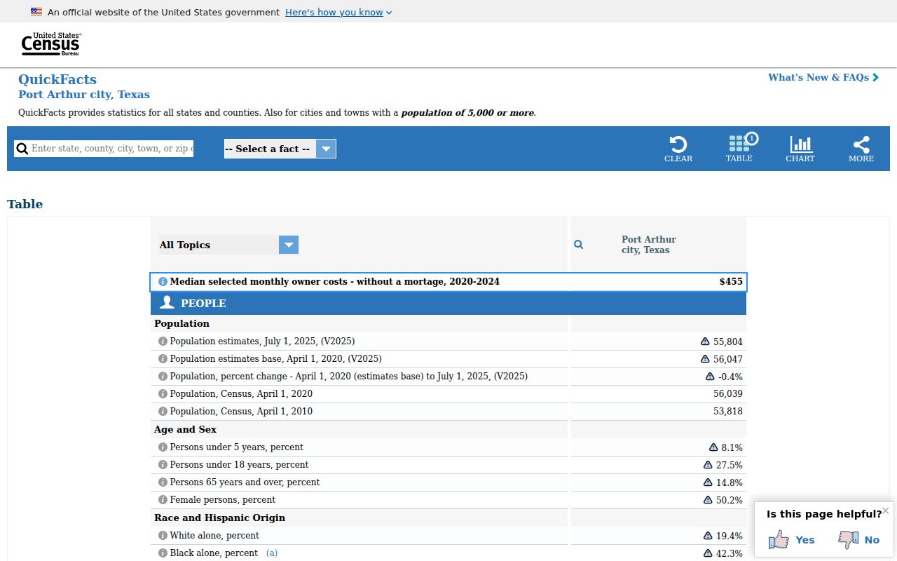
Use a city profile for context, then return to USPS for delivery and to GIS for the municipal boundary. Those tools answer different questions and should not be substituted for one another.
Port Arthur Addresses Before ZIP Codes
Older Port Arthur research cannot begin with a ZIP because pre-ZIP city and telephone directories may not print one. Start with a street name, neighborhood or vicinity label, subdivision, block and lot, precinct, or post-office name. The Hughes directory shelf covers Port Arthur from 1925 through 2006 with gaps; UT metadata documents Worley vicinity issues and Southwestern Bell volumes. Sanborn maps can supply historical house and block numbers, property boundaries, and building context, but they do not name every occupant.
For deeds, use the legal description, not a modern ZIP string. The County Clerk portal searches grantor or grantee, subdivision, document type, document number, and recorded date. When the current online portal does not reach the target era, TSLAC holdings include Jefferson County deed records and direct or reverse index microfilm. A pre-ZIP address should be preserved exactly as printed alongside its later standardized form.
Port Arthur ZIP Code Evidence Limits
A ZIP code narrows a mailing or delivery question. It does not verify a person, ownership, current occupancy, or an incorporated-city location. USPS says its result does not confirm a person or company at the address. JCAD can return a situs, appraisal account, and owner mailing information, but it directs users to verify legal descriptions and acreage before legal use. County Clerk records can document recorded instruments, yet an owner in a deed is not automatically the person living at the site.
Use independent matching context before connecting a name to an address. Port Arthur city directories, deeds, permits, public maps, and obituary or cemetery leads each describe different facts. Restricted voter and protected-address information remains subject to Texas rules. A missing or withheld address is not by itself a failed identity match.
Port Arthur ZIP Code Office Routes
When online results do not resolve an address, the documented alternatives are direct. Port Arthur Planning and Zoning can be reached at 409-983-8135 or 409-983-8139, city main at 409-983-8100, County Engineering at 409-835-8584, and JCAD at 409-840-9944 or 409-727-4611. Request historic street-name, annexation, permit, or map records from City Secretary, Planning, or County Engineering with the address and map date. For municipal material, the Port Arthur open-records request route accepts a precise written description.
Library and archive options also help with old labels: Hughes for directories and Sanborn material, Port Arthur Public Library for local collections, and TSLAC for maps and microfilm. State the address, date range, document series, and the geographic question that needs confirmation.