
Port Arthur Previous Resident Sources
Different sources reach different eras of a Port Arthur address. A Port Arthur parcel account is a starting point, not the whole answer. Recorded instruments follow ownership. Street and surname sections can show who was listed at an address in a particular edition. Maps and permit files add building or boundary context. The strongest trail notes the edition, document number, map date, page, and exact address form used at every step. That makes it possible to separate a transfer of title from evidence of a past household.
| Source | Years it covers | Where held | What it can show |
|---|---|---|---|
| JCAD appraisal account | Current tax-year data; online backfile start not published | JCAD | Situs, legal description, owner and mailing fields, improvements, and deed-history leads |
| County recorded index | Current portal; online historical start not published | Jefferson County Official Records | Grantor, grantee, recording details, legal description, and document references |
| TSLAC deed records | Deed Record 1834-1887; deed index 1836-1888; selected deeds through 1939 | TSLAC and depository microfilm | Earlier deed books and direct/reverse index entries |
| Hughes directory shelf | 1925-2006, with gaps | Marion and Ed Hughes Public Library Archive Room | Dated address, household, subscriber, or business listings |
| UT directory metadata | Worley 1921-1958; listed telephone issues 1924-1998 | UT citations and library access routes | Edition, publisher, date, and vicinity coverage leads |
| Obituary index | 1969-2026 | Port Arthur Public Library | Name, age, obituary date, page, and status notes |
Start with JCAD and the Clerk when the Port Arthur property is recent enough for current parcel details. For an older period, move to the appropriate directory edition and deed reel. A printed endpoint at Hughes does not prove that no later directory exists elsewhere, and a missing online result does not settle the older title history.
Start a Port Arthur Deed Trail
The Port Arthur address-to-title bridge is the legal description. In JCAD, capture the Property ID, Geographic ID, situs, legal description, owner name, owner mailing address, improvement details, and any deed-history row. The sample parcel 326302 shows why this matters: its Port Arthur situs, Block 11 Tract 2 description, and Houston mailing information are separate fields. A mailing line is not a statement that an owner lives at the property, and an owner is not automatically one of the previous residents.
Once the legal description is recorded, use it with the County Clerk’s search term, date range, and grantor or grantee fields. The Port Arthur title trail uses the current official search for a grantor/grantee, subdivision, document type, or document number. It also offers Index Only and Index and Full Text OCR modes. Search names in more than one form when needed, including middle initials, spouses, entities, and “et al.” Keep a separate line for each spelling rather than merging uncertain parties into one person.
Note: JCAD says its online information is for research and directs users to verify legal descriptions and acreage before legal use.
Trace Port Arthur Previous Resident Deeds
The backward deed process follows transfers, not occupancy. For a Port Arthur property, start with the present owner or the latest deed-history lead, find the acquisition instrument, then use the seller as the next party to search. The goal is a chain of linked records with the same legal property description. Compare the grantor, grantee, deed type, recording date, volume or page, document number, and description at each turn. If the description changes from street address to a subdivision, tract, or block, keep both forms in the timeline.
- Find the current parcel in JCAD and write down the legal description and identifiers before searching names.
- Look for the latest transfer in the County Clerk index by document number, party, subdivision, or recorded-date range.
- Read the instrument or request its copy, then identify the seller and the exact description carried by the deed.
- Search that seller as a later grantor and a prior grantee, using spelling and entity variations when the index calls for it.
- Repeat the sequence backward until the current portal no longer reaches the needed era.
- Move to the Clerk counter, TSLAC microfilm, or a written request for the earlier books and reels.
- Grantor
- The party transferring an interest in a recorded instrument.
- Grantee
- The party receiving that interest. A later grantor search can lead toward that party’s earlier acquisition.
- Chain of title
- The ordered sequence of transfers for a property. It can establish title chronology without identifying every household.
- Legal description
- The tract, block, lot, subdivision, or other property wording used in an instrument. It usually survives address-format changes better than a street number.
Jefferson County Microfilm Trail
Jefferson County records are layered across books, microfilm, fiche, paper, and newer imaging. For Port Arthur address history, TSLAC identifies Deed Record 1834-1887, direct and reverse deed-index coverage from 1836-1888, selected deeds from 1839-1939, and related tax and election series. The Sam Houston Regional Library and Research Center adds county court docket, trial docket, deed-record and index, naturalization, civil-case, precinct, and tax-related holdings. These are the route when an online index does not reach the desired period.
TSLAC says county-record reels can be viewed at TSLAC or depositories and may be requested through library loan, generally up to five reels for fourteen days with a possible extension. Sam Houston holdings do not circulate, so reading-room research is the alternative. The District Clerk’s imaging history also shows why an open web screen may not reveal every available record. Public terminals and a written request can reach material that is not exposed through a general link.
The TSLAC Jefferson County deed-index guide is the source entry point for the older county record route.
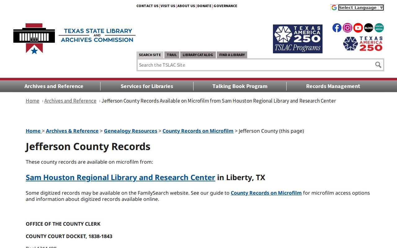
Use the guide to select the correct series and dates before requesting a reel. Record the reel, book, page, and search date with any item found.
Pair Port Arthur Directory Years
Past residents are more often found in a dated listing than in a deed. Hughes holds a detailed Port Arthur run beginning in 1925 and ending with 2005-2006 holdings, with many gaps between editions. UT describes a Port Arthur and Vicinity Worley run that includes 1921, 1923, 1931, 1957, and 1958. Southwestern Bell metadata covers listed issues from 1924 through 1998. The headings matter because Port Arthur and Vicinity volumes can include Griffing Park, Groves, Lakeview, Nederland, Pear Ridge, Port Acres, Port Neches, Sabine, and Sabine Pass.
UT Austin’s Port Arthur and Vicinity directory metadata identifies the Worley years and geographic scope.
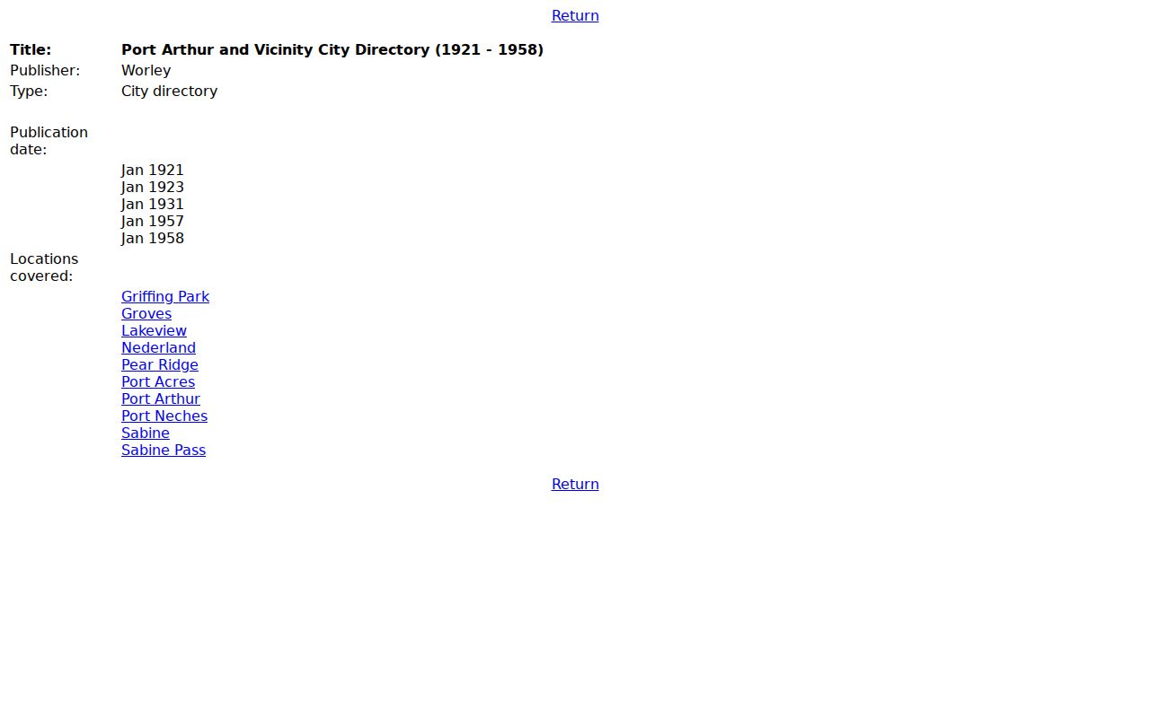
The citation metadata helps select a directory issue before an archive or library request, then the entry itself should be compared with address and deed evidence.
- Choose the closest available directory before and after the year in question, noting whether either edition is missing.
- Search the street or reverse section at the address and both adjacent house numbers, when the edition has that section.
- Search each listed surname in the alphabetical section for initials, spouse conventions, a telephone subscriber, or another address.
- Pair the dated household clue with available census, obituary, cemetery, deed, or permit material that supplies matching context.
- Mark the result as a directory listing, not an ownership or current-occupancy claim.
The collections and their access details are organized in the Port Arthur Directory Book. For an address history, use the book as a source shelf, then return the relevant street and party names to the timeline.
Note: A directory gap or an absent surname can reflect a missing edition, an unlisted number, a changed label, or a different spelling.
Date Port Arthur Address Changes
Building context can keep a name trail from attaching to the wrong structure. Port Arthur permitting records can be requested by exact address, legal description, date range, and record type. A Port Arthur request can seek building, electrical, plumbing, mechanical, stormwater, demolition, elevation certificate, certificate of occupancy, or remodel material that fits the period. A permit or inspection can anchor work to a date and name an applicant or contractor, but it does not prove that person lived there.
Sanborn sheets add block-level evidence. A 1918 Port Arthur sheet in UT GeoData can show house and block numbers, footprints, construction material, occupancy labels, property boundaries, water and fire context, and industrial features. Match the sheet with a directory street section and the legal description. The map can explain why a number or building description changed, but it does not identify every occupant.
Port Arthur Previous Resident Labels
Boundary history explains many false breaks in a past-resident trail. Port Arthur’s records reflect platting in 1895, a 1913 limited extension along the Sabine-Neches Canal and Sabine River, city-limit actions in 1950-54, 1976 and 1978 limited annexations, the 1999 Bridge City ETJ release, the 2005 Taylor’s Landing release, and 2017 industrial or limited-annexation action. Lakeview, Port Acres, Sabine Pass, Griffing Park, and nearby community names can therefore appear in older entries without matching a modern map label.
No official source in the research confirms a wholesale citywide renumbering year. Do not assume that every number mismatch is a renumbering. Compare the old street spelling with a plat, Sanborn map, annexation map, permit file, and nearby directory numbers. The legal description is especially useful when a historic deed uses a tract, block, or subdivision instead of the modern street format.
Port Arthur Past Household Evidence
The household layer can close a trail after the property records stop. Port Arthur Public Library’s Port Arthur News Obituary Index has year pages from 1969 through 2026, with visible name, age, obituary date, page, and status or notes. An obituary result is a surname and date lead, not a certified death record. Library genealogy resources, newspaper access, and local-history collections can help locate the next source without turning a notice into a full address history.
Jefferson County’s Historical Commission reports more than 74 cemeteries and graveyards, and its scanned books include Calvary Catholic Cemetery and Port Arthur Memory Gardens material. A cemetery section or marker can connect a directory surname to an obituary date and area. Confirm any interment detail with the cemetery operator. Probate can also provide an estate record, but its availability and copy type should be confirmed with the County Clerk.
Lawful use. Port Arthur previous-resident research is appropriate for family, estate, and property history. Never use an address trail to stalk, harass, threaten, or harm someone.
Port Arthur Archive Access Paths
A remote search is only one channel. Hughes Archive Room lists its local-history shelf at 2712 Nederland Avenue and publishes 409-722-1255. Port Arthur Public Library’s genealogy and obituary resources are another local route, with 409-985-8838 listed for the library. UT citation metadata can identify an issue to request. The Jefferson County Historical Society catalog includes more than 27,000 records, with few items digitized; remote researchers can note an identifier and contact research@jchsmuseum.com for digitization guidance.
For government-held address material that is not publicly searchable, use a city or county written request with the address, legal description, record series, and date span. The Texas Public Information Act supports requests by reasonable mail, fax, email, or in-person procedures, subject to applicable exceptions and charges. Library and historical-society collections may follow their own access terms. The Sam Houston Center’s Jefferson County holdings show the archive route beyond an open-web index.
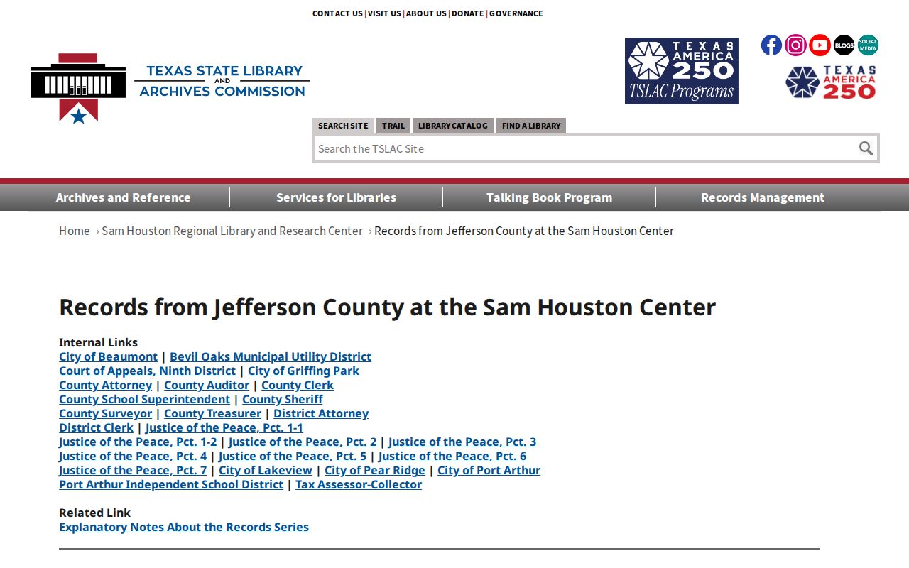
The holdings list is a planning tool for an in-person or archive request. Match the proposed record series and date range before contacting the repository.
Port Arthur Previous Resident Limits
Previous residents cannot be proven from a single field. A deed can show a transfer but not who occupied the property. JCAD can show a Port Arthur situs and an owner mailing address in another city. A telephone directory may show only a subscriber, and a city directory may use a household-head convention or omit a number. Voter information is current registration data with protected-address rules, not a retrospective street-by-street history. Treat each item as one dated piece of a larger record trail.
Port Arthur’s recordkeeping is also uneven by era. For Port Arthur, county books and microfilm reach into the nineteenth century, directory metadata begins in the 1920s, and newer imaging sits alongside public-terminal access. Archive silence can mean an unscanned reel, a missing edition, a changed geographic label, a protected record, or a real absence. Preserve the source, date, and search terms so another researcher can test the result without repeating assumptions.